
Thanks to the detailed digital cartography and the precise scales, freytag & berndt hiking maps are ideal companions for hiking, mountaineering and ski tours. They are regularly revised and contain updated information on hiking trails, cycling and mountain biking routes, huts, natural monuments, cultural sights and leisure facilities. The titles of the "Outdoor Pocket" series fit in every pocket thanks to the handy format of 9 x 15 cm. They are waterproof and therefore suitable for any outdoor adventure! Hiking and long-distance hiking trails, mountain bike and cycling tours, register of places with postcodes, cross-country ski trail, ski route, elevation profiles, tips on adventure, cuisine, nature, sights and hiking; Region: Rax, Schneeberg, Vienna Alps, industrial district, Lower Austria; Special themed hiking trails: Lower Austrian circular hiking trail, Northern Alpine trail, Mariazeller trail, Ghega-Semmeringbahn railway trail, circular hike via the Friends of Nature House on the Knofeleben, Schneeberg plateau hike; Waterproof and tear-resistant The hiking map is printed on a special waterproof and durable paper so that it can also be used for orientation on rainy days. Manufactured in a way that conserves resources The map consists of 80% ground limestone. The production is much more resource-saving than with conventional paper because the consumption of water, wood and energy is significantly lower. Schneeberg plateau hike; Waterproof and tear-resistant The hiking map is printed on a special waterproof and durable paper so that it can also be used for orientation on rainy days. Manufactured in a way that conserves resources The map consists of 80% ground limestone. The production is much more resource-saving than with conventional paper because the consumption of water, wood and energy is significantly lower. Schneeberg plateau hike; Waterproof and tear-resistant The hiking map is printed on a special waterproof and durable paper so that it can also be used for orientation on rainy days. Manufactured in a way that conserves resources The map consists of 80% ground limestone. The production is much more resource-saving than with conventional paper because the consumption of water, wood and energy is significantly lower.
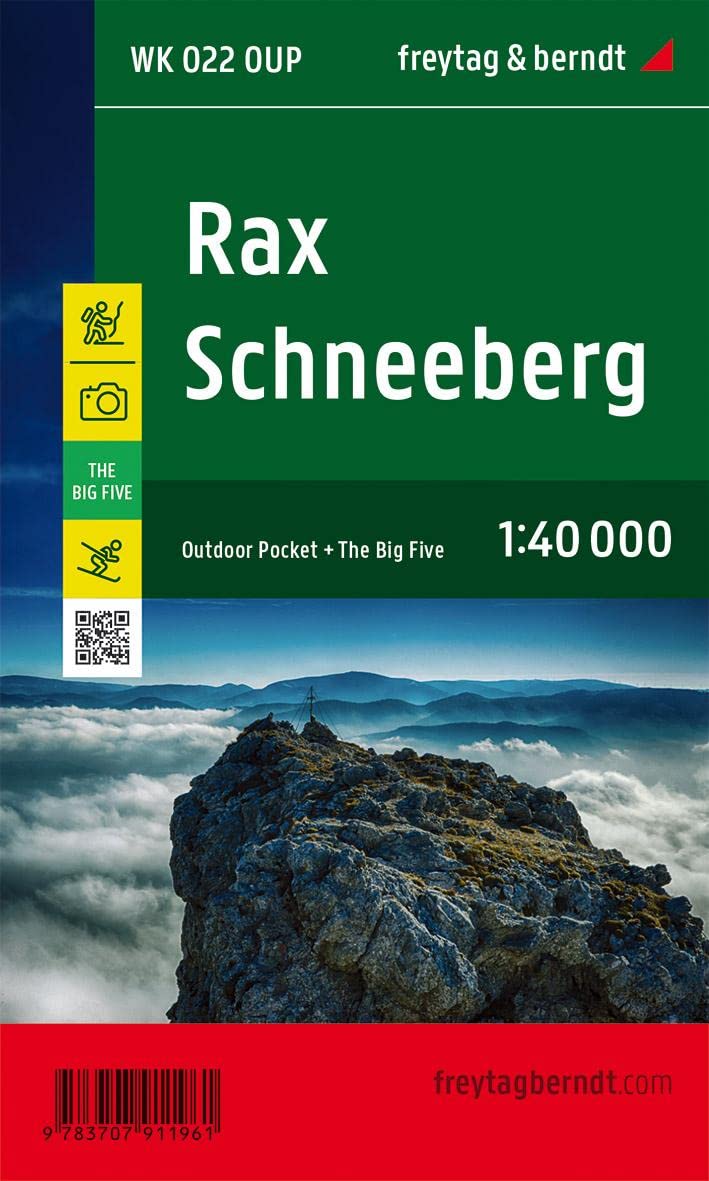
Rax - Schneeberg Hiking + Leisure Map 1:40 000
Categorii:
Limba:
Engleza
Data publicării:
2017
Editura:
Tip copertă:
Paperback
ISBN:
9783707911961
Dimensiuni: l: 9cm | H: 15cm | 0.7cm